
File:LF map haz.png

Size of this preview: 424 × 600 pixels. Other resolution: 2,480 × 3,507 pixels.
Original file (2,480 × 3,507 pixels, file size: 764 KB, MIME type: image/png)
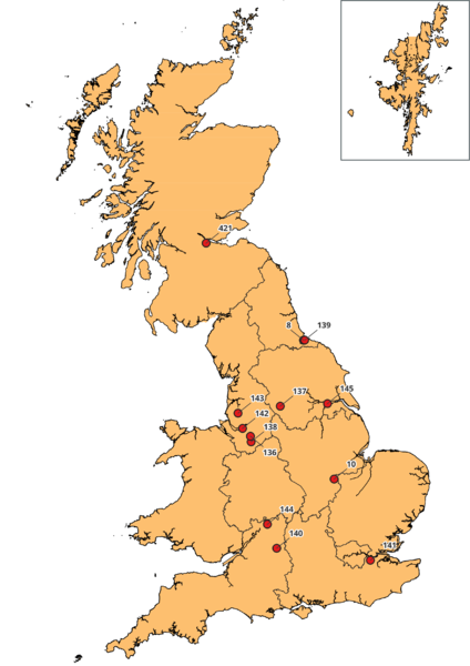
Map of the Hazardous Landfills in Great Britain
File history
Yi efo/eka'e gwa ebo wo le nyangagi wuncin ye kamina wunga tinya nan
| Gwalagizhi | Nyangagi | Dimensions | User | Comment | |
|---|---|---|---|---|---|
| current | 12:05, 5 April 2022 | | 2,480 × 3,507 (764 KB) | Admin (talk | contribs) |
You cannot overwrite this file.
File usage
The following page uses this file: